political urbanism- an urban catalogue of “good living”

AIA Martin Roche Scholar 2015
Travel research project financed by the AIA Chicago

The rise and fall of political leaders, the development of society, economic demands and crises have shaped cities and architecture throughout history. This study aims to dissect the factors that frame, create and drive the appearance of new urban conditions in a time where Ecuadorian history is in the making.

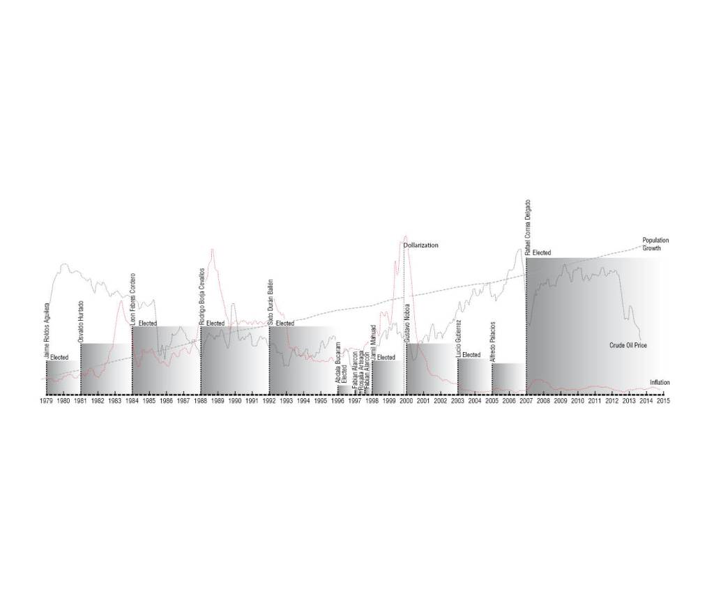
The Republic of Ecuador after years of unstable, temporary governments, most of which were overthrown by the people, is now experiencing one of the longest and deepest political movements in the past 30 years. This Revolución Ciudadana (Citizen Revolution) as the local authorities call the movement, has deeply reshaped the urban landscape of the country. This movement is seeing its trajectory shaped by an overarching master plan
“ El Plan del Buen Vivir”. The plan stands as the root and guiding principle to massive governmental investments in various development and social projects stretching across the country.

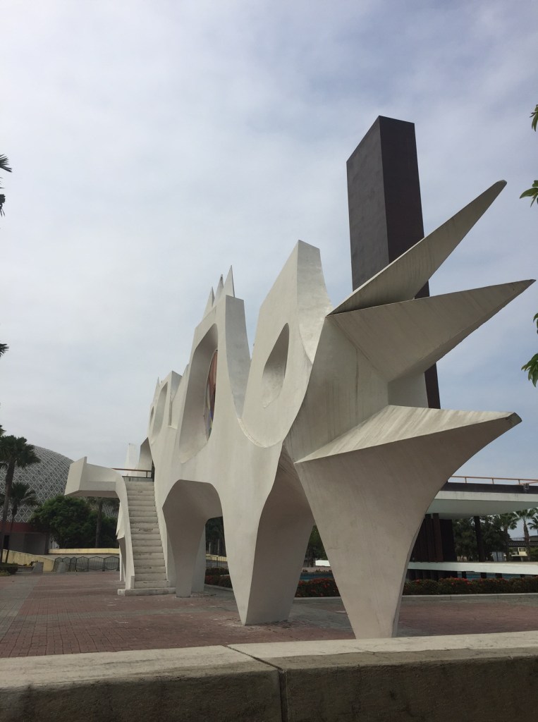
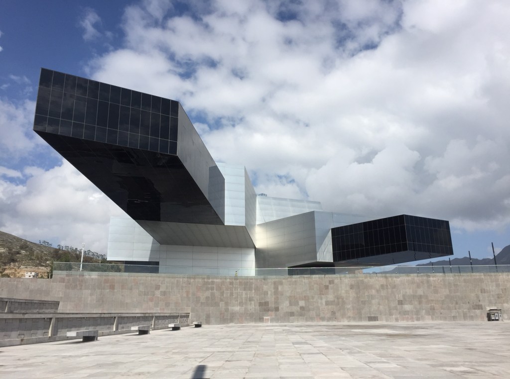
The signs of this strong movement are seen throughout various corners of the country. The projects range from the micro buildings with a singular purpose, to the development of mega cities in remote areas. These urban interventions witnessed by the country vary in type and scale, but all carry a concrete agenda of the state’s development plan.

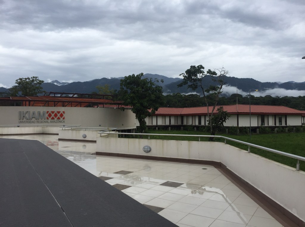
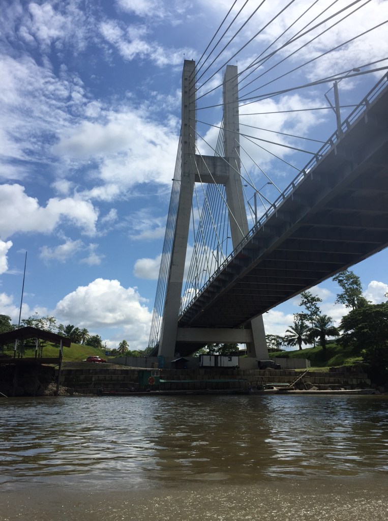
The remote location of this project and other constructions in settings such as the Amazonian jungle demonstrate investment in areas traditionally overlooked by past leaders. These Urban Interventions carry an agenda of a participatory and decentralized democratic republic, which is clearly depicted by the large range of locations, scales, and types of projects. Ecuador presents a unique setting that is in the core of a massive urban,
infrastructural, social and political development. The study aims to catalogue how from the beginning of this comprehensive political movement, the country has been reshaping its urban landscape. Ecuador is in the midst of an urban experiment in which the government is using architecture and urbanism as a key vehicle to declare a new democratic republic of “Good Living”.

The journey focused on visiting a range of these strategic projects that vary in type and stages of development. Visiting a total of 10 projects and traveling 1,500 miles within the country, an inventory of these urban conditions has been crafted. The lessons of these ambitious interventions are collected in this “Catalogue of Good Living”. The aim is to analyze this unique model through different lenses. This approach will allow the discovery of how all these interventions condense into a unique type of urbanism that is shaping the history of Ecuador and the future of its urban landscape.

spatially unstable

Work in collaboration with Matthew Busscher

SPATIALLY UNSTABLE proposes the encounter of an interactive installation through this journey within nature. Bringing the dynamics of movement into the experience of Fontelo Wood. Conventionally sculptures subject the individual to static forms, which create static sections, and static experiences. Movement, however, brings a playfulness to the relationship between individual and space. Replicating the movement one can find in nature, and the interconnectivity that elements in a forest like the Fontelo Woods have, the proposal aims to entice the visitors to explore how they can mold their space.

The materials chosen for the installation are readily available and of simple modular assembly. PVC pipes for it’s main structure allow a rapid and low skilled assembly. The fabric modules are all the same dimension, but are designed to shrink and extend with the pulley mechanism. The translucent fabric chosen plays with the way that light travels from module to module, similar to the playfulness of the sun’s rays and the tree leaves in the site.

Hence SPATIALLY UNSTABLE aims to embolden the curiosity of an explorer, with an experience where the explorer can change and manipulate his or her own realm. A realm which is also subject to the manipulation of others. The creation of the field then becomes both an individual and a community endeavor, which yields unexpected results. The pulley system of each fabric module allows visitors to playfully change its height. This, thereafter, combined with the entirety of the field, creates different combinations of landscapes that can be explored and altered with each visitor.

pocket plaza

Research Studio – University of Illinois at Chicago – Spring 2015

The public plaza is undergoing an unprecedented transformation. Historically plazas and public squares have been defined by the building that surround them, and often design in tandem. The Mayan square and temple dace each other, as do the Italian piazza and the church. The French place is surrounded by uniform housing blocks. The corporate plaza is an extension of the lobby. The plaza currently has no firm relationship to buildings.

The project rewires the fundamentals of plaza design to combine flat and three dimensional platonic forms in multiple orientations simultaneously and integrally. The project takes The Alcoa Building in San Francisco by SOM as a case study to rethink the building plaza relationship. The stark difference between the levels of the street, plaza, and building are challenged by the creation of “pocket plazas” that carve spaces in the existing plinth , creating hybrid space between public and private.

yaku : planeta agua – Zoom

work done in the Ecolution Ecoengine Team – Built by the Museum of Water in Quito Yaku

The “Yaku: Planeta Agua” open call for exhibition proposals gave our team the opportunity to present the conceptual, spatial and material framework for an exhibition that explores water at its different scales in our society. The Evolution Ecoengine team won the competition, and worked with the city water museum Yaku in the city of Quito to develop the exhibition. Based on the winning proposal our team developed the Museological-Museographic script.

The resulting exhibition aimed to expose the importance of water at different scales in the daily life of any living being, also to conceptualize that we must have a relationship with water as a being. It begins with the World as the largest introductory scale and ends with the Person as the smallest closing scale. The rooms designated for the exhibition were iconic water reservoir vaults, which originally served as the main water supply for the city of Quito before the creation of the museum in the year 2005. These vaults despite being independent spaces are designed to be a connected narrative of transition between scales of water. The act of zooming in throughout the 6 vaults, the exhibition demonstrates the influence of water in different frames and its consumption in different activities which could be a waste or a function of its own environment.

With a total of 6 scales distributed in each vault of the museum, the proposal was audiovisual and interactive techniques that appeal to all types of audiences, but mainly children. The idea was for audiences to experiment in a range of sensorial activities how water travels from its natural origin to human use. This was to lead to a higher awareness of water and hence a better coexistence.

The exhibition was executed by the museum team and private contractors, opening its doors to the public on August 2019.

pliant city

work in collaboration with Arq Kevin Aragón and Arq. Belen Acurio

The proposal for adaptability is founded in the volatility of our setting. Hence to think of resiliency, one must design to adapt. To achieve this, replicable modules are used to create flexible living quarters.These are independent both in construction and as structure, and can be inserted into existing buildings to create inclusive communities. This module is built to enable and proliferate networks of green houses and vegetation throughout the city. Moveable panels and built-ins in the living quarters adapt to existing apartments and homes, they allow for interior flexibility during domestic periods.Through the collection of data in a city app the modules and city adapt to change. Publically, the City of Mutuality is designed for change and adaptation, and thus urban furniture is flexible and allows for the orchestration of bike lanes and streets through rails, according to communal and pedestrian needs.

Our modern world is undeniably an unprecedented time. Yet, with unprecedented times come unprecedented opportunities. The challenges we face are catalysts for change; changes which urges the urban setting to adapt and revamp. The Pliant City, is not merely an urban environment, but a proposal for a set of strategies that embody the idea of a flexible, adaptable and resilient city.

the ultimate stabuur

competition entry 2020-collaboration Arch. Kevin Aragón

The Norwegian landscape is characterized by long stretches of fjords, lakes and rocky mountains covered by extensive forests. This Nordic country, once inhabited by the Vikings, has traditionally built and used log constructions for shelter and refuge. The traditional stabbur is an iconic symbol of the landscape and culture of the Norwegian countryside. Originally built for food storage, today the various stabburs found in Norwegian homes serve a variety of purposes. The stabbur is characterized by 3 main elements, its elevated base supported by pilotees, the first level that was meant for storage , and the top one that was inhabited.  Inspired by this charming staple of the norwegian scenery, the idea of the ultimate stabbur emerged.

nested domes

autumn 2014- University of Illinois at Chicago

The project explores historic disciplinary material to extract operative diagrams of the creation of voids; then design the protocols for the assemblage of second-order systems, and then the experiment of carving the existing Merchandise Mart in order to introduce new notions of urban interiority. The notion of urban interior will be approached as an alternative to collage cities and the accumulation of programs by designing voids that exhaust the differentiation of specific categories laid out by the proposed diagrams.

The Victorian Animal is taken as the diagram to combine two different systems. The operations of dome proliferation developed parametrically, but implemented manually, are combined with one another to stablish a strategy for the growth of the dome field applied to the existing structure of the Merchandise Mart.

The 18th Century library is studied as the program to drive the system. The Merchandise Mart is taken as a shell. The Dome proliferation produces nested interior urban spaces than then produce floor plates from their intersections The main domes are generated from the existing corridors and entrances of the Merchandise Mart. The proliferation of these geometries study the interior nesting conditions generated by the system.

linking boundaries in alna

autumn 2020 – The Oslo School of Architecture and Design

The neighborhoods of Haugerud and Trosterud are at the edge of the urban fabric of the city of Oslo. They are demarcated by dominant edges, the Alna river, the Oslo rift and the forest Øst Marka. This old farm land now houses a generic and functionalist suburb with extensive asphalt surfaces and green deserts. Nonetheless the edge layers found in the area possess great potential which is absent from the current landscape found on the site.

The design proposal aims at canalizing the potentials found in the site to construct a landscape that fosters connectivity and identity. The site of Trosterud is chosen as the main focus of intervention given it’s layers of challenges that are utilized as potentials in the design strategy. The site has large extensions of underutilized parking spaces and service underpasses that cause severe flooding at the T-bane station with high rain. These underused spaces hence have insecurity problems. Nonetheless the site has a privileged elevation which frames views of the hills and markas surrounding the city.

The proposal focuses on 3 main edges, the belvedere rock, the rain garden and the production history edge. The belvedere rock edge opens up the asphalt to shine a light on the unique geology of the site and open up the views to the city. The rain garden aims at storm water retention and the creation of a wetland ecosystem to improve the now green dessert found in between the two rows of buildings. Finally, the last edge focuses on the farming history of the site and the demand for allotment gardens. The proposal uses landscape as a tool for identity and connection but also as a response to storm water flooring and soil suffocation.